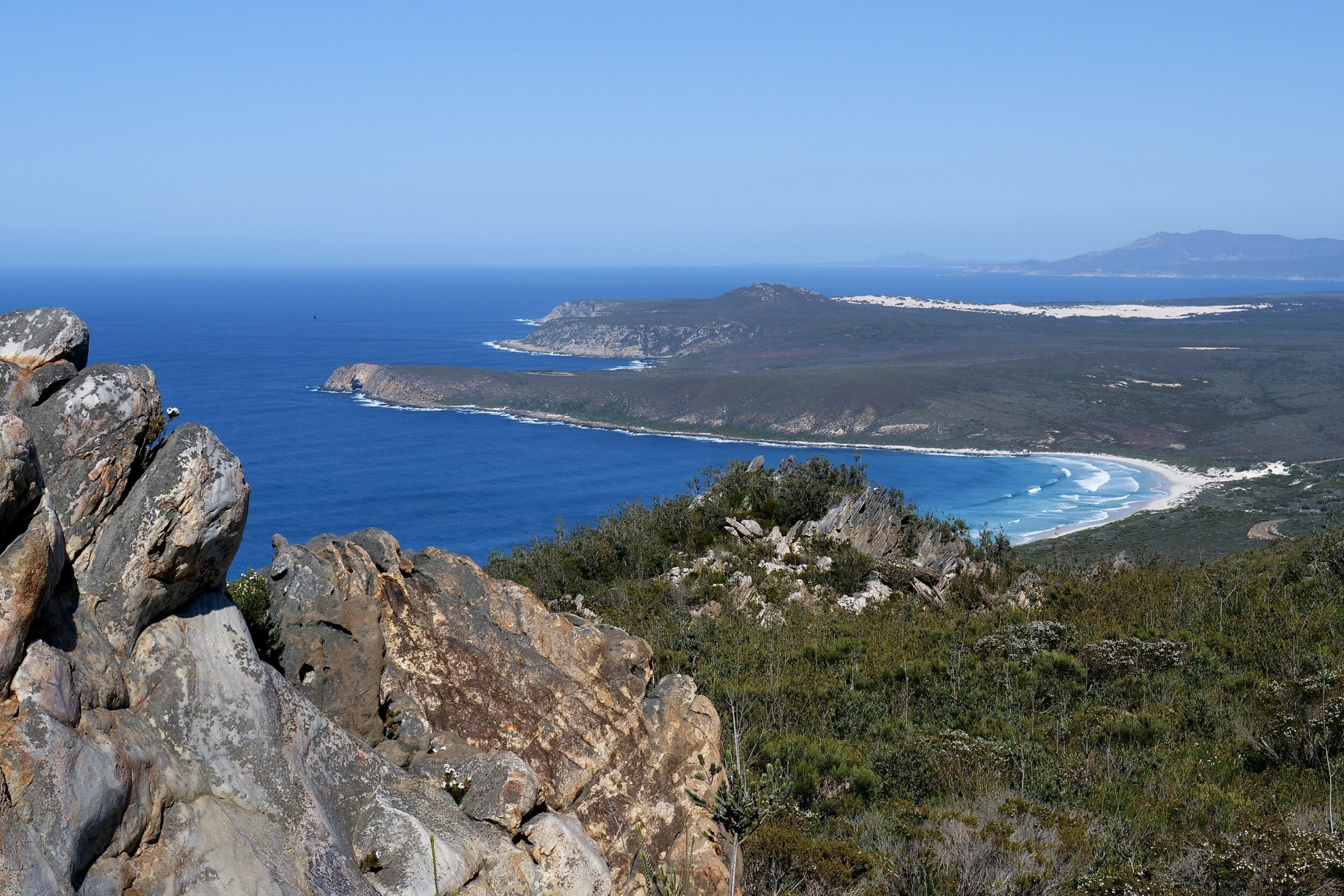
Sitting 450 metres ASL, atop Mount Barren at 9:43 am on 21 September 2021, all land within my westward field of a view – and very much more, well beyond it – was part of Fitzgerald River National Park.
To the west, the nearest coastal town was Bremer Bay, just outside the National Park’s western boundary.
Were I able to fly, Bremer Bay would be 80 kilometres distant from my vantage point.
By road, the distance is nearly twice that – the near-coast road only extends a few kilometres west of East Mount Barren
If I were to attempt to reach Bremer Bay by walking along the curving, very wild coastline – a glorious combination of huge, white-sand beaches, coves, and very rugged headlands – it would take me rather more than a few days.
Such an expedition would require a very high level of fitness, probably an airdrop or two, and the ability to swim and/or wade in “treacherous” waters.
Almost certainly, my attempt would fail; if it did succeed, I would have walked/scrambled/waded/swam for at least 130 kilometres!
For Mediterranean climate flora, “the Fitz” is undoubtedly “our” planet’s greatest national park.
The floral diversity and the high degree of endemism are mind-boggling, as is the scenery.
Pelican Yoga has many “Fitzgerald” posts; click this for easy access to some. (this post’s photo has already appeared in one of them)
This series’ next chapter takes us thousands of kilometres further east, to a higher rocky summit, from which one can look down upon mainland Australia’s southernmost sandy strands.
Footnote
Q: why is the colour of the Quartzite rock in the foreground of this post’s photo not the “regulation” grey-to-white-ish hue?
A: in part, because it has been “stained” by the “rusty” presence of hematite – an iron oxide which is very abundant in WA. And lichens – which do not require soil – are thriving on some of the rock surfaces.