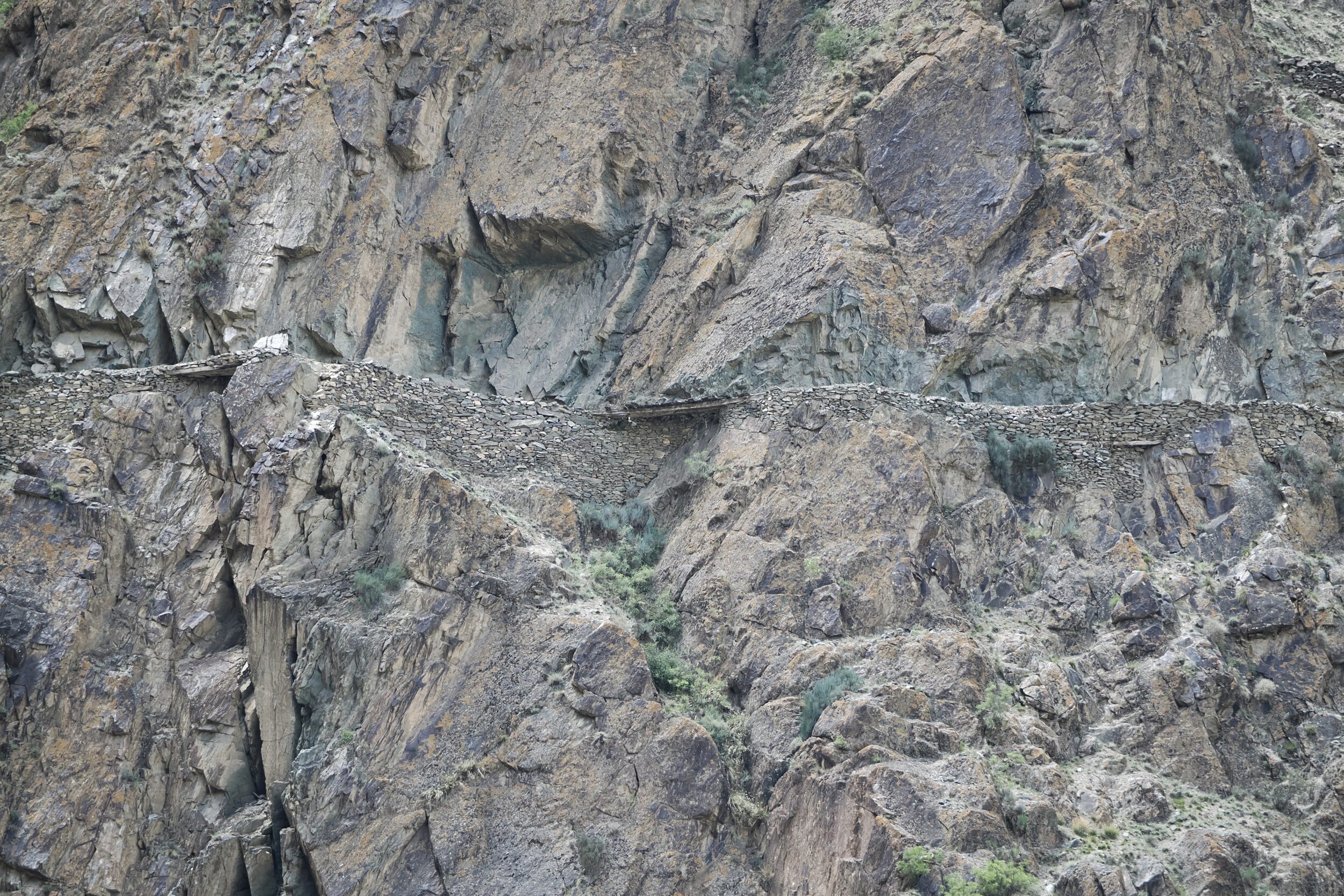
Just a couple of minutes after our “welcome” to the “home” of an emblematic but “invisible” mammal (see immediately-previous post) we looked up from the Karakoram Highway, and over to the far side of the gorge through which we driving.
There, in plain but inconspicuous view: a section of a much older road.
”The Silk Road” was in fact a network of various roads and tracks which spanned more than 6,400 kilometres.
“Silk Road” was a tag coined by Europeans, in the 19th century.
Eurasia’s – mostly, Asia’s – “Silk Road” routes had been established more than 2,000 years earlier.
The “Silk Road” network retained its importance for more than 1,500 years.
The pictured, cliff-hugging section is well above the flood-reach of the river below it.
It is also intermittently-shielded, by overhanging rock faces.
Those overhangs would have reduced the risks posed by avalanches and landslides – both of which are not rare events in the Karakoram.
Photo is ©️ Doug Spencer, taken at 11.34 am on 20 May 2024, whilst en route from Gilgit to the Hunza Valley.