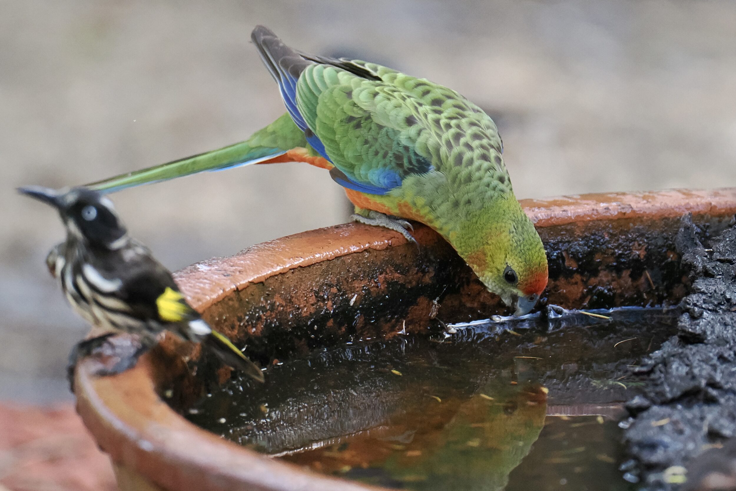
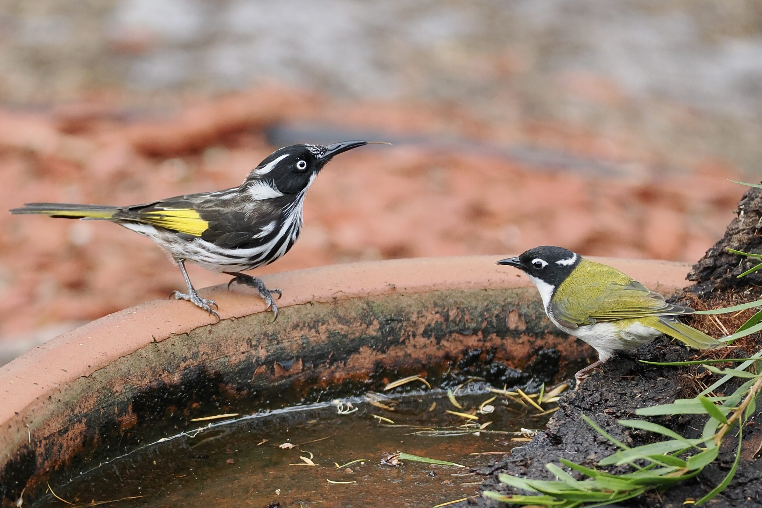
This post’s photos were taken about 40 minutes after we had crossed the “vandalised” footbridge over the Denmark River.
Both show the same individual.
Leave a CommentNatural splendour, real musics, wines, wordpower
This post’s photos were taken about 40 minutes after we had crossed the “vandalised” footbridge over the Denmark River.
Both show the same individual.
Leave a Comment
The image shows the sign on the footbridge over the Denmark River, as recently modified.
Leave a CommentHarewood Forest is definitely not “virgin”.
Until well into the 19th century it was a pristine, very tall, Karri-dominant forest
By circa 1900 no grand trees remained; all millable timber had been “mined”.
Happily, however, the forest has regrown well.
Magnificent as are southwest WA’s tall trees – all, WA-endemic – they are far from their forests’ only “WA-only”, wonderful/wondrous-strange plants.
Leave a Comment
Where else in the world could one be less than 20 kilometres distant from an eminently civilised town of more than 40,000 permanent residents (plus a large number of tourists) , and enjoy the pictured experience?
My beloved and I are not visible in the featured image.
It does, however, show all other humans present at Muttonbird Beach during the late afternoon “golden hour” on 21 March 2021.
To reach this glorious, safe-swimming spot, on a perfect “beach day”, we drove for less than 30 minutes, on good roads…
Leave a Comment
Some well-meaning 20th/21st century humans have viewed the pictured dunes as an unfortunate byproduct of 19th and/or 20th century overclearing and overgrazing.
In fact, this particular dune field was already part of the local landscape long before Europeans reached any part of Terra Australis.
Leave a Comment
20 kilometres southwest of Pemberton, in southwestern WA’s “Karri country”, the Yeagarup Dunes cover circa 30 square kilometres.
They are the Southern Hemisphere’s largest mobile, land-locked dune system.
The Yeagarup Dunes are currently advancing inland at circa 4 metres per year.
This post’s photos were taken from the top of their “hungry” edge, on 27 October 2016.
Leave a CommentMandalay Beach is near Walpole, in Western Australia’s “Deep South”.
I have seen many wild ocean beaches – on every continent, bar Antarctica.
Mandalay Beach – named after a ship that was wrecked there in 1911 – is one of my all time favourites.
It is really wild (do not swim there) but easy to reach; any able-bodied, sensible driver of a 2WD vehicle will easily “manage” both the track that leads off the South Coast Highway and the short walk from car park to beach.
In every direction, the vistas are splendid.
However, you should never forget, also, to keeping look down to the sand at your feet. (ditto the rocks, any clefts therein, and the rock pools)
Leave a Comment
Banky Beach is just one of the many beautiful beaches and coves in and around Bremer Bay, on Western Australia’s south coast.
By road, Bremer Bay is 180 kilometres closer to the preceding post’s location – Aldinga Beach – than is Albany.
From Bremer Bay, the drive to Adelaide is a mere 2,530 kilometres!
Aldinga is 45 kilometres south of Adelaide.
Western Australia has (by far) the longest mainland coastline of any Australian state or territory.
Leave a Comment
Anvil Beach sits at the end of the Nullaki Peninsula, just east of where Irwin Inlet (sometimes) meets Southern Ocean.
It is one of the more “choice” of many wild and wonderful beaches on Western Australia’s south coast.
The proverbial crow – flying in from Denmark, not many kilometres distant, to the northwest – could reach Anvil Beach in just a few minutes.
Comments closed
After taking in the panoramic view across Thistle Cove – as featured in this series’ previous chapter – we walked down to the beach.
This post’s photos offer a closer view of the “stained” water and sand that were visible in the bottom right side of #16’s photo.
You are looking at a freshwater spring’s waters flowing onto the beach at Thistle Cove.
Comments closed