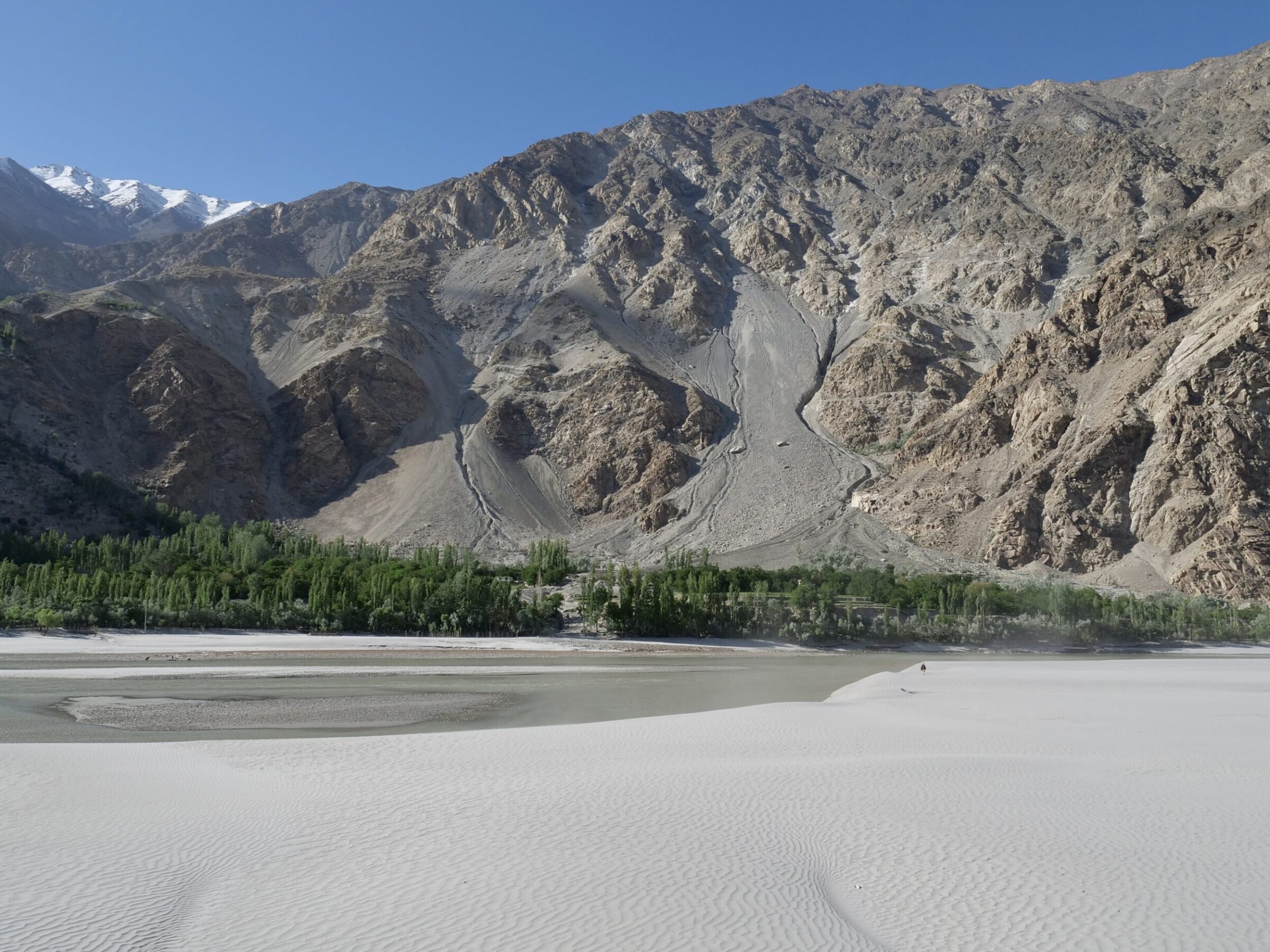
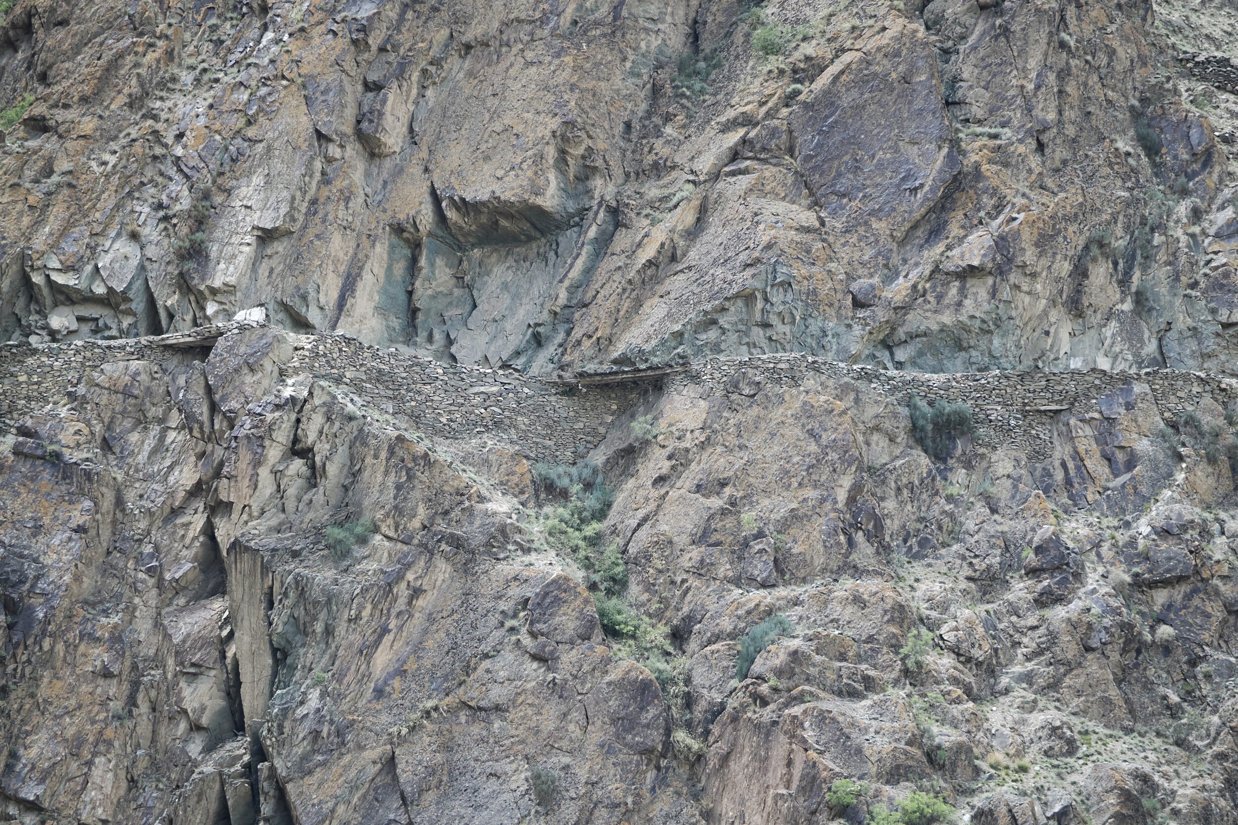
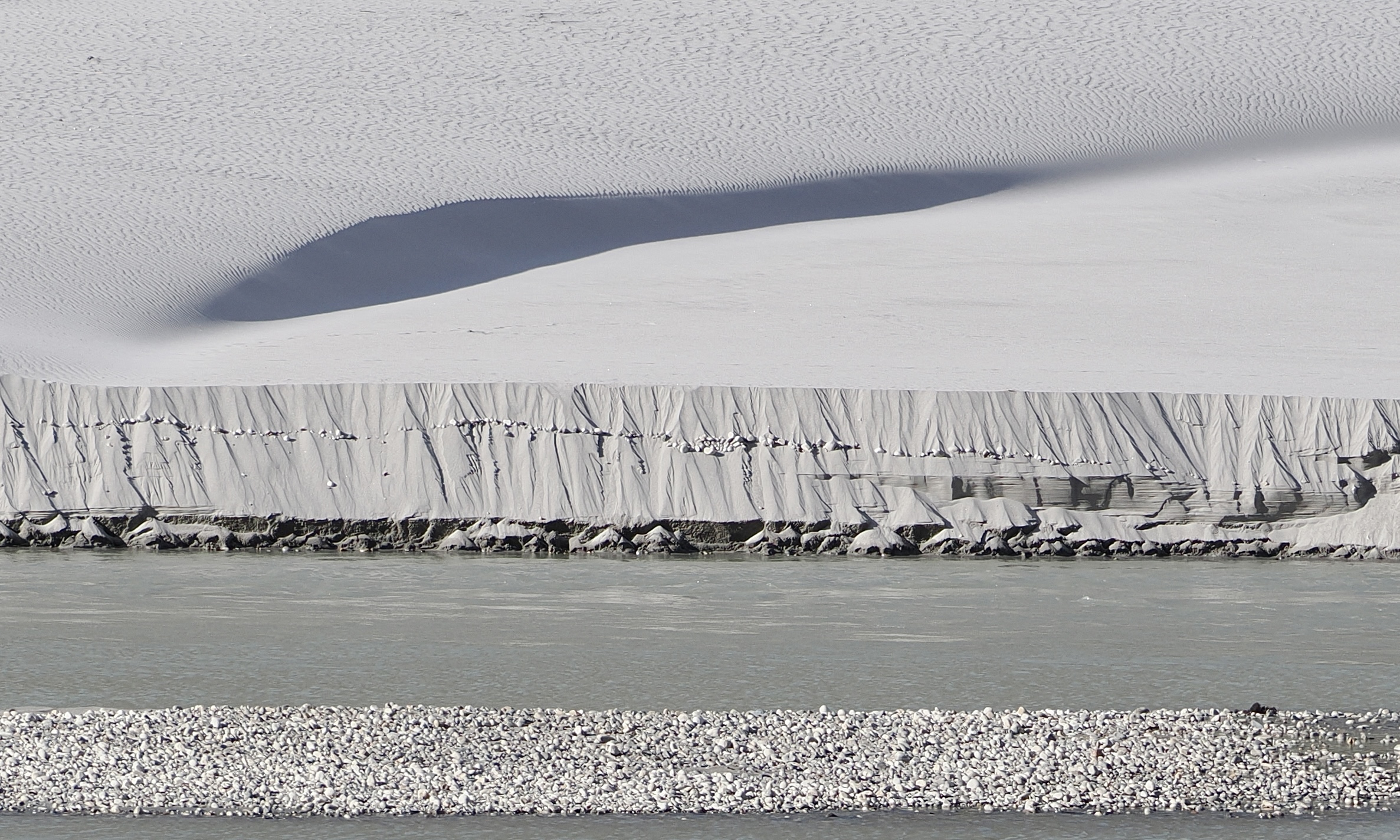
Skip to content →

Tag: Pakistan

Triple K “expedition” (#35 in teaser series: heading for the border)


You are looking at the Passu Cones, aka “Passu Cathedral”, or Tupopdan.

These “cones” reach 6,106 metres ASL – a relatively modest altitude, by Karakoram peaks’ standards.

Nonetheless, the Passu Cones are among the more amazing mountains, anywhere.

I took the photo at 8.09 am on 23 May 2024; we had left the Hunza Valley one hour earlier, and were heading along the Karakoram Highway, bound for China.

At that moment the Pakistan/China border was less than 70 kilometres away, but a long way up; the border crossing sits atop the Khunjerab Pass.

Comments closed

Triple K “expedition” (#34 in teaser series: Hoper Glacier)


This post reveals the nature of what #33 in this series was also looking at – a glacier’s surface.

This post shows rather more of the same glacier, which is one of circa 7,000 in Pakistan.

Outside polar and near-polar regions, northernmost Pakistan is the most-glaciated place; the Karakoram has several of the world’s longest and biggest, non-polar “rivers of ice”.

You are looking at what is most commonly known as the Hoper Glacier, but sometimes rendered as “Hopper”, “Hopar” and “Hooper”.

It also has another name, altogether: Bualtar Glacier.

Its nickname: “the black glacier”.

Reportedly, the Hoper/Bualtar is currently the world’s second-fastest-moving glacier.

Comments closed

Triple K “expedition” (#33 in teaser series: an artist’s creation?)


…or is that very uneven surface a naturally-eroded rock face?

Did I take the photo through a microscope?

Was I merely a few centimetres away from what my camera “captured”?…or many metres distant?

All will be revealed in this series’ next chapter.

Comments closed

Triple K “expedition” (#32 in teaser series: Hunza Valley)


Among “our” planet’s “settled” places,  the Hunza Valley has very few peers in the “visual splendour” department!

It will get a deal of future attention, here.

However, this “teaser” series has just the one Hunza Valley image.

I took it from Eagle’s Nest which sits 2,850 metres ASL – around 500 metres higher than the (clearly-visible) Hunza River, on the valley floor.

Dominating the photo’s skyline is Rakaposhi; that huge mountain’s peak stands nearly five kilometres taller than the Eagle’s Nest.

Comments closed

Triple K “expedition” (#31 in teaser series: Karakoram mountain meadows + musical bonus & concert tour alert)


This post’s image does not at all resemble #30’s shot of a “Silk Road” remnant.

Its vantage point, however, was only a few footsteps distant from #30’s; #31’s photo was taken less than a minute later, from the same side of the Karakoram Highway, whilst en route from Gilgit to the Hunza Valley.

Comments closed

Triple K “expedition” (#30 in teaser series: “Silk Road” remnant)


Just a couple of minutes after our “welcome” to the “home” of an emblematic but “invisible” mammal (see immediately-previous post) we looked up from the Karakoram Highway, and over to the far side of the gorge through which we driving.

There, in plain but inconspicuous view: a section of a much older road.

Comments closed

Triple K “expedition” (#29 in teaser series: emblematic, elusive)


The Karakoram Highway is surely the most visually spectacular major road, anywhere.

On 20 May 2024, we were proceeding along part of it, en route from Gilgit to the Hunza Valley.

At 11.26 am – circa one hour out of Gilgit – the pictured sign welcomed us to the “home” of Pakistan’s national animal.

The markhor is often described as the world’s largest wild goat.

In terms of average body mass and length, that claim is probably incorrect.

However, an “average” male markhor’s shoulder height exceeds all other goats’ “average” shoulders

So, Capra falconeri  probably is the world’s most imposing goat.

Comments closed

Triple K “expedition” (#28 in teaser series: Gilgit, relatively “big smoke”)

Above, you are looking at “downtown” Gilgit.

“Official” statistics – and guesstimates – for anywhere in northern Pakistan are highly “rubbery”, contradictory, and often very out of date.

Almost certainly, Gilgit is the Karakoram region’s largest city, with a population of circa 200,000…ish.

Comments closed

Triple K “expedition” (#27 in teaser series: inevitability, uncertainty & contrast)


If this post’s two photos were “the only available evidence”, you could assume – reasonably – that they were taken from vantage points far distant from each other.

In fact, the image below was taken less than sixty seconds after the one above, with the very same lens.

Above, I was looking across a Karakoram valley’s floor to the mountains on the far side

For the image below I had turned my head 180 degrees, shuffled my feet accordingly,  then looked straight up the nearby, steep, stark, but seemingly more modest slope… our proximity to the relevant ridge (atop which the boulder perched) would have enabled it to “hide” any higher ground behind it.

As you can see, an “accident” was waiting to happen…

Comments closed

Triple K “expedition” (#26 in teaser series: an older resident of Markunja)


A few minutes later, the pictured gentleman walked out of the mosque’s courtyard and into the village’s main road/through street.

Clearly, he was someone for whom other villagers “looked out”.

I saw a shopkeeper welcome him,  and make him a cup of tea; no money changed hands.

All photos in this series are “candid”; I dislike photos of people who are “mugging” for the camera/ “smiling”, on demand. (and I detest “selfies”)

Comments closed