Skip to content →

Tag: volcanoes

Grand sands (#55 in series: Indonesia’s only “sea of sand”)


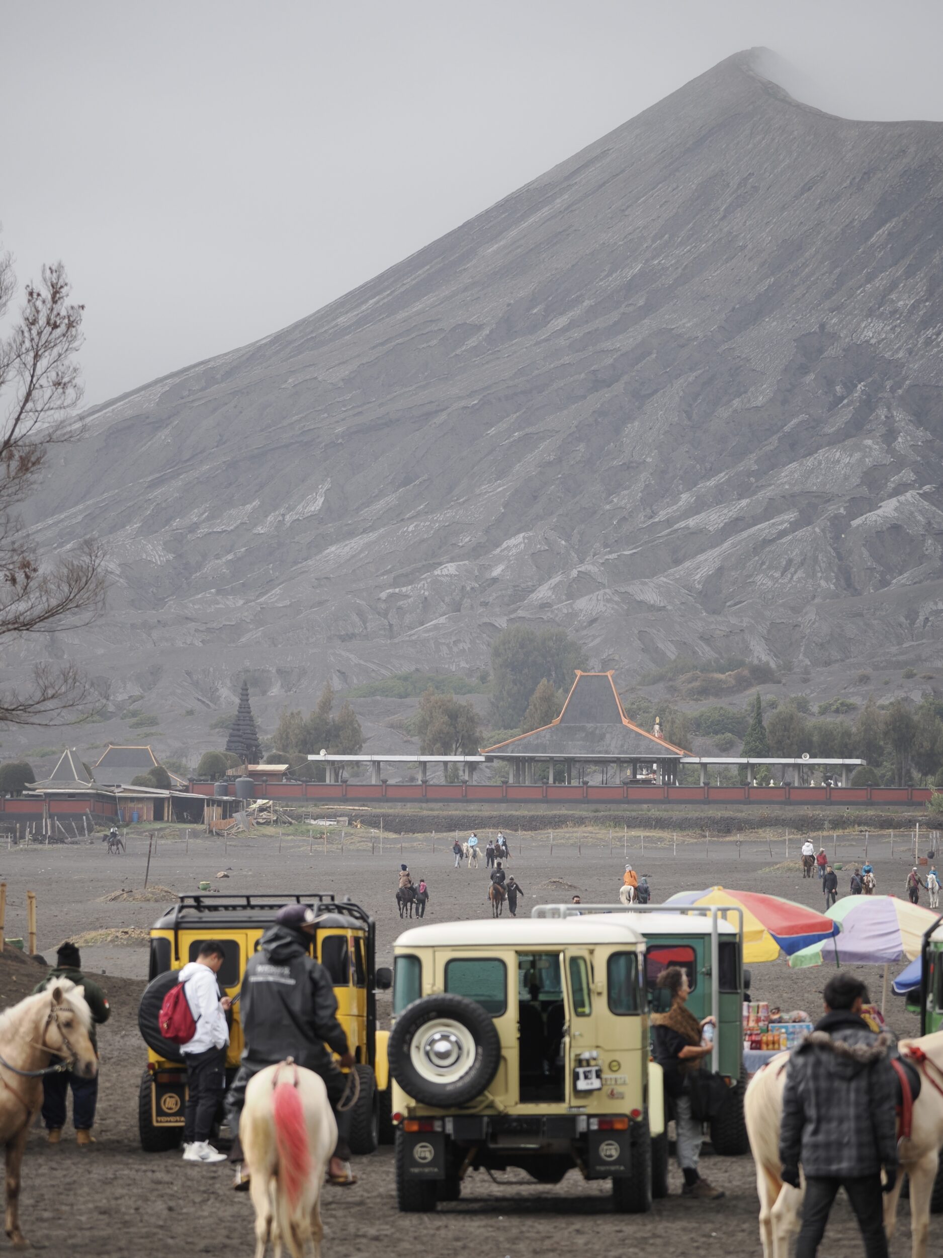
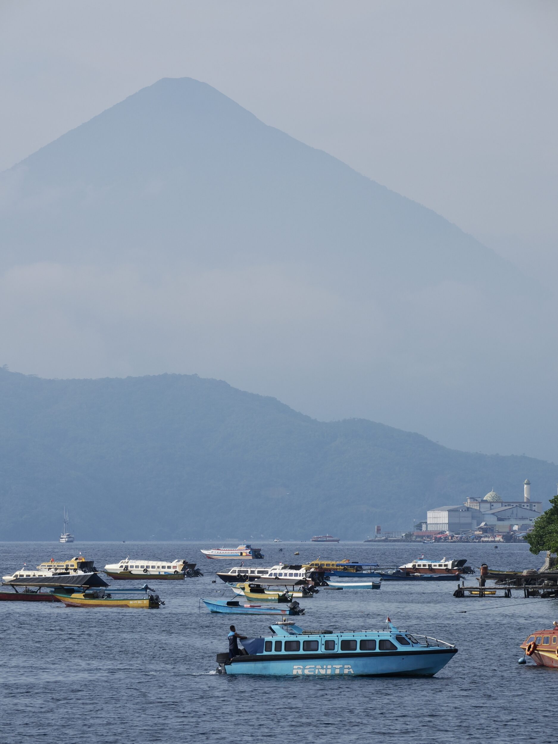
East Java’s Bromo Tengger Semeru National Park (aka, within Indonesia, as “TNBTS”) contains multiple volcanoes.

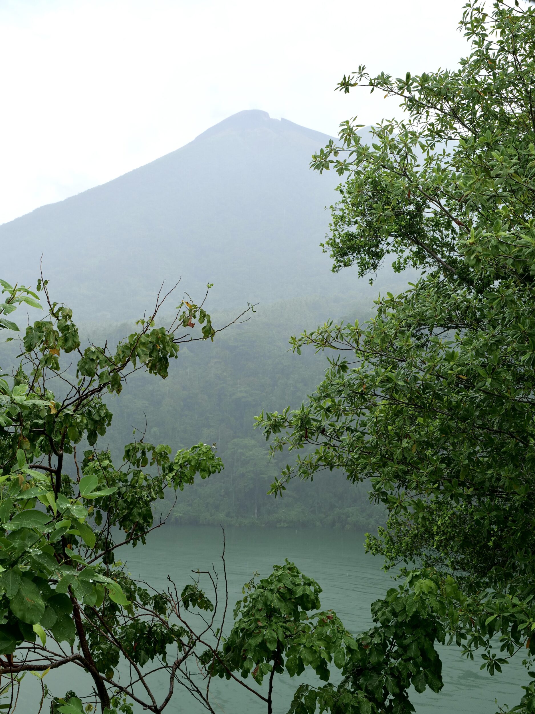
Mount Semeru (3,676 metres) is Java’s highest peak, atop which snow sometimes sits, albeit briefly.

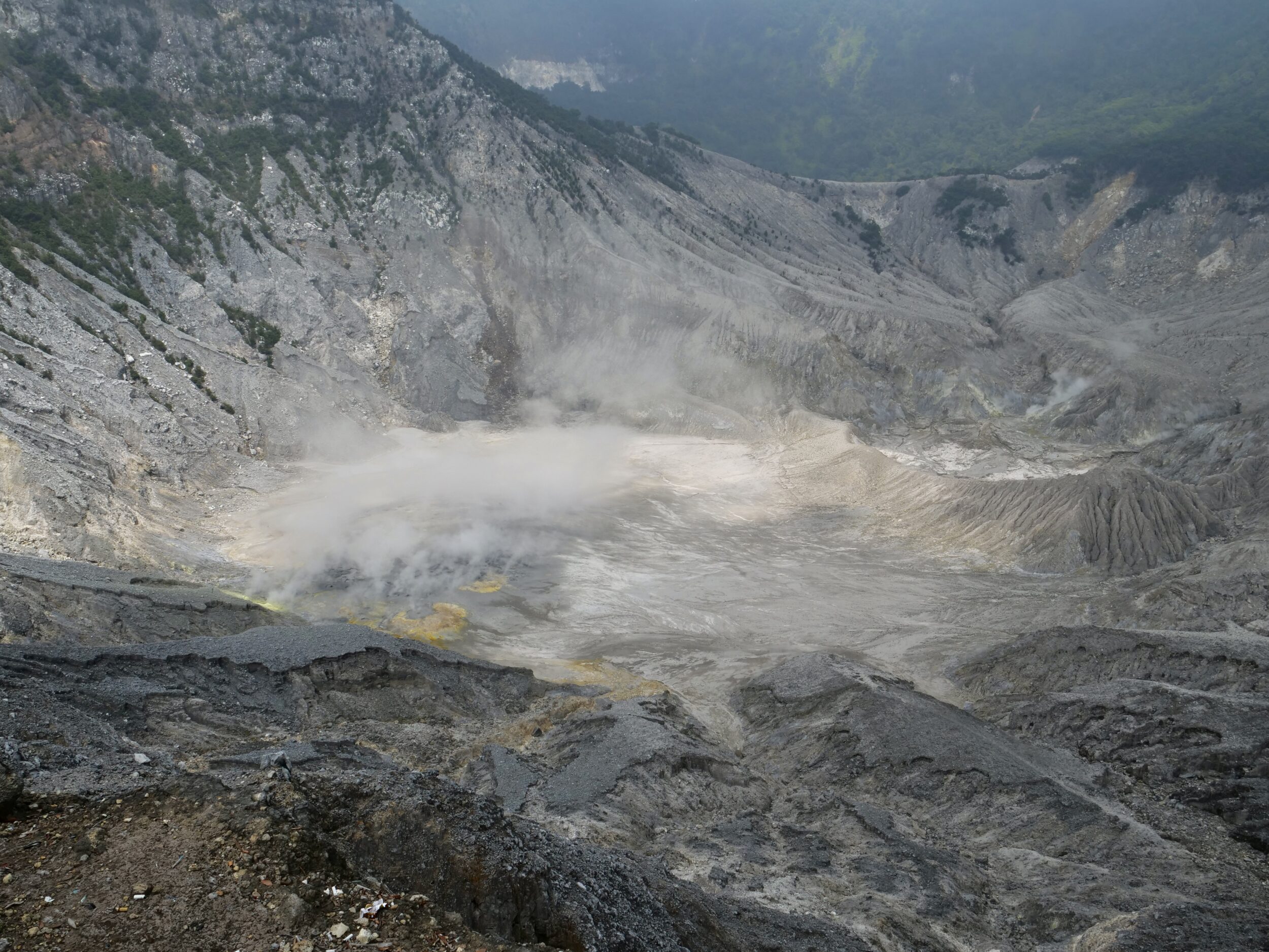
However, the park’s “tourist magnet” is a volcano that is much less lofty, but currently much more active

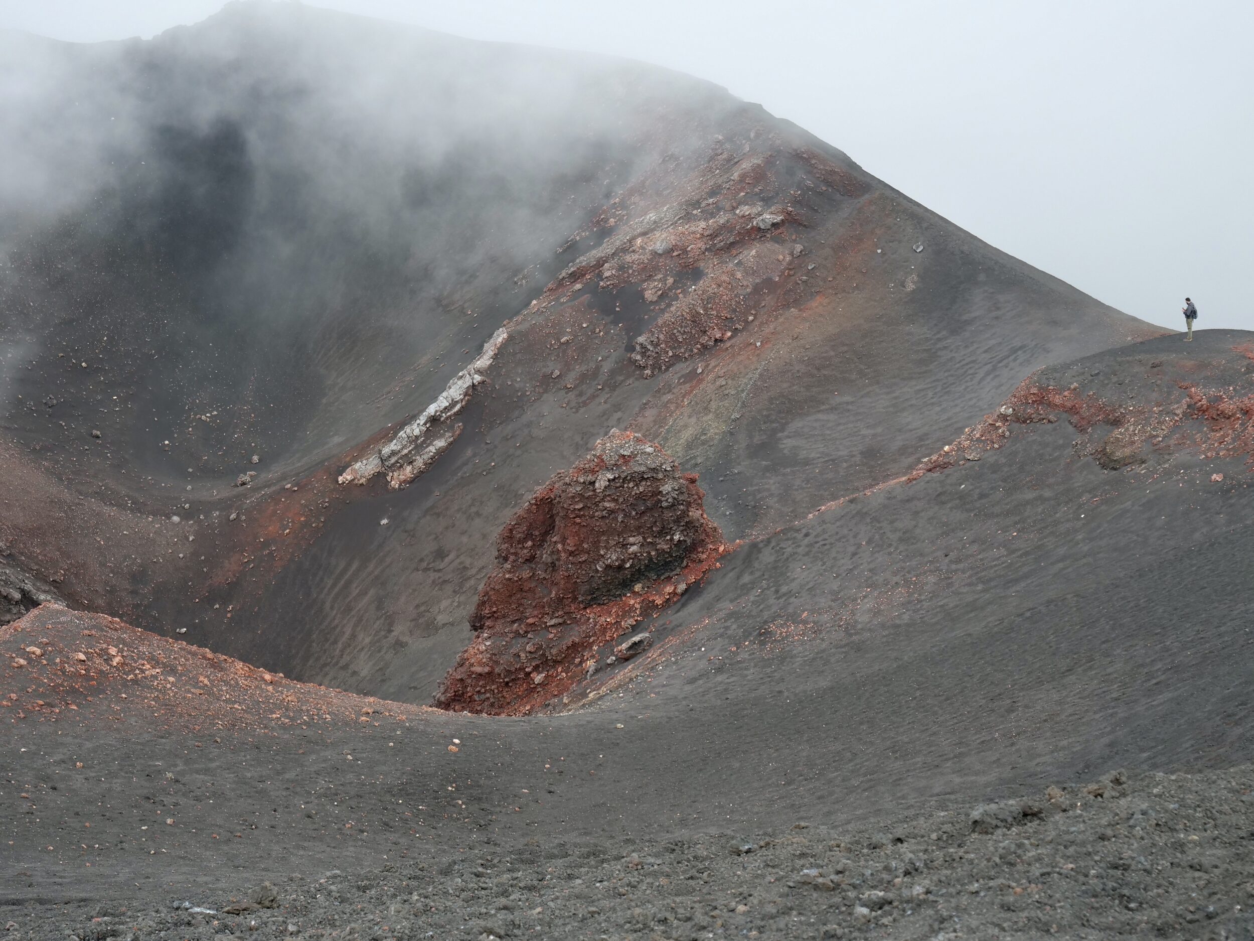
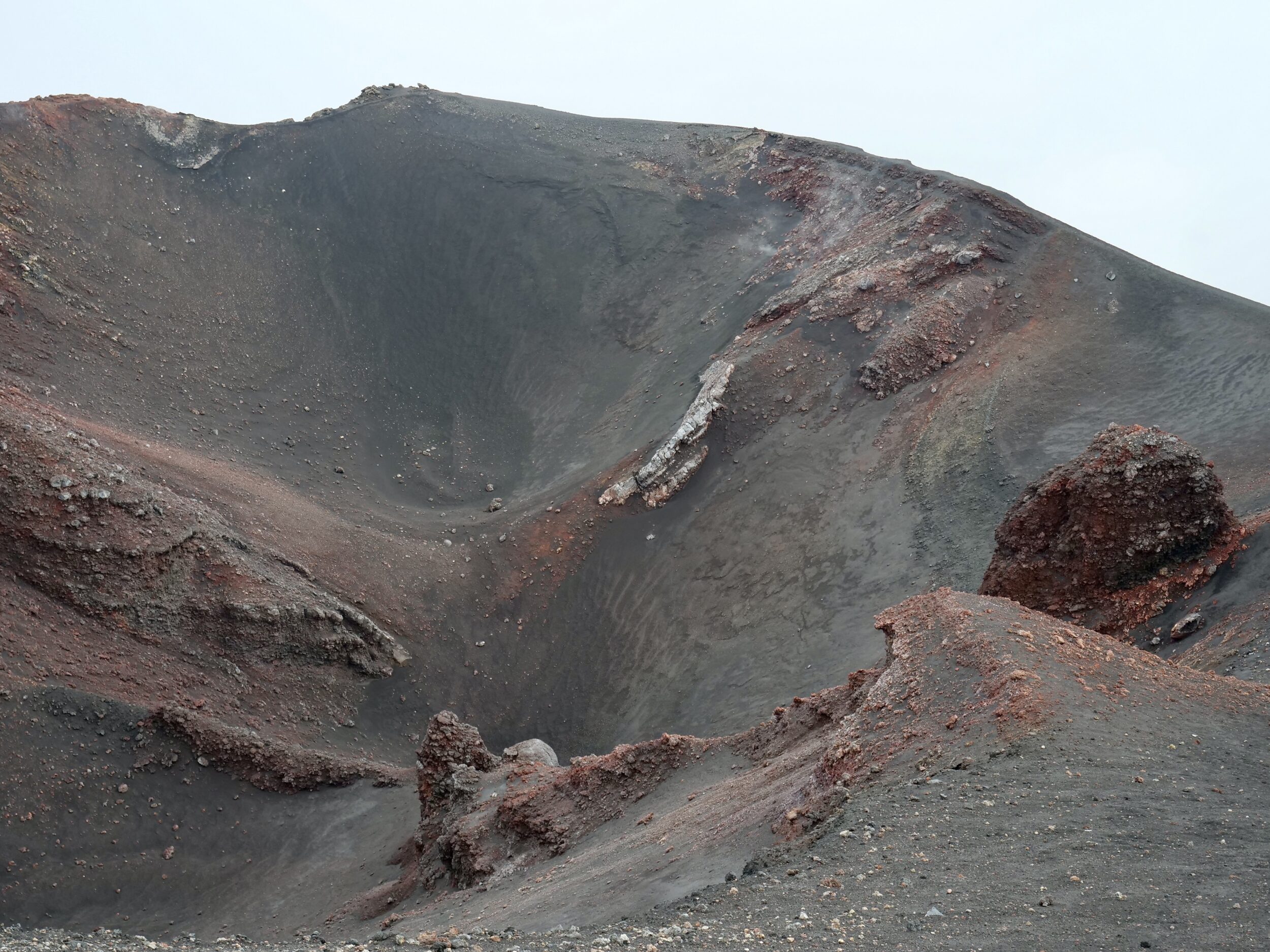
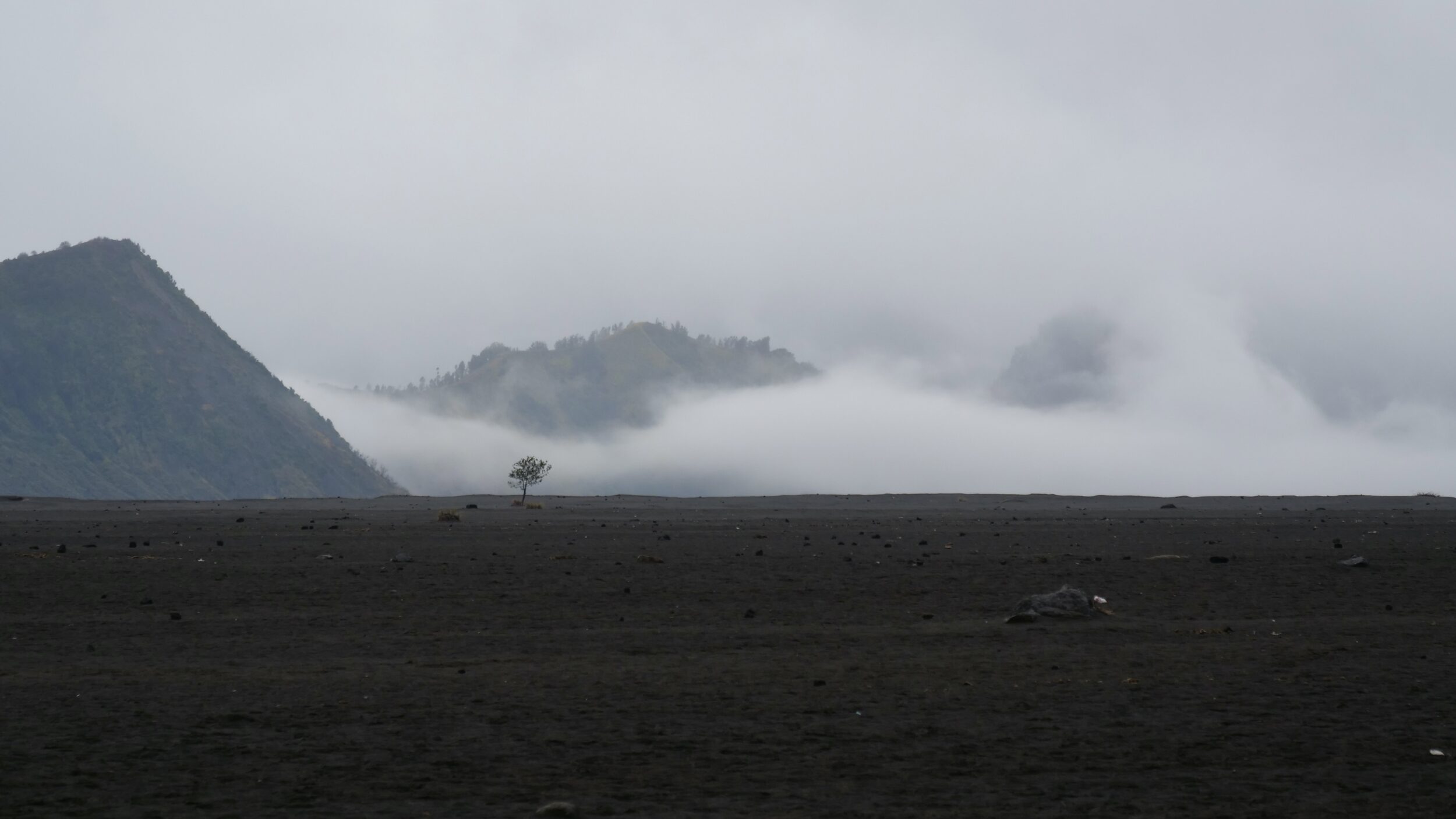
Mount Bromo (2, 329 metres) is surrounded by Indonesia’s only desert-like expanse.

Bromo is one of the four or five “new” volcanoes (visibility was limited when we were there. some sources say “four”, others say “five”)  that have arisen from the floor of the huge caldera created by the much older Tengger volcano.

The Tengger Sand Sea’s “sands” are a mix of volcanic ash and sand – the mostly-basaltic “fruit” of Bromo’s eruptions.

Leave a Comment

Grand sands (#54 in series: “black” sand beach, Taranaki, NZ)


The Taranaki region is named after the volcano that dominates it.

Some people still call it “Mount Egmont”.

One of the world’s most “perfect”/photogenic volcanoes, Taranaki is the primary “author” of the region’s obviously-fertile soils…and of its “black” beaches.

Leave a Comment

Indonesia 2024 (final in teaser series: flycatcher, with catch)


Indonesia’s enormous number of volcanoes includes many active ones.

Whereas an active volcano’s crater is typically stark, precipitous and raw, its flanks’ appearance is likely to be more varied/variegated, according to where eruptions have – or have not – scorched or gassed them, rained down ash and/or lava rocks/boulders, or sent molten lava flowing…

A single volcano can “author”many different things.

Gorgeous rainforests and prodigiously fertile soils can sit adjacent to “devastated”, seemingly-barren (sometimes, relatively briefly, actually-lifeless) zones.

One stream’s waters may be safe to drink, whilst another’s, nearby, could be highly toxic.

This teaser series’ final episode features what was in fact the last photo I took on Javanese soil in 2024.

Comments closed

Indonesia 2024 (#34 in teaser series: the greatest “acid cauldron”)


“Our” planet’s largest highly acidic lake is the one in Kawah Ijen – the Ijen Crater.

I took this post’s photo from the rim of Kawah Ijen, in almost-easternmost Java, at 5.51 am on 24 October 2024.

My beloved and I were at circa 2400 metres above sea level, with the lake’s surface some 200 vertical metres lower than our feet.

The red fabric in the foreground is trying to tell tourists “do not venture any closer to the crater’s edge”; it was placed there not many moons ago, soon after a Chinese tourist’s fatal fall.

Comments closed

Indonesia 2024 (#33 in teaser series: active volcano in “sea of sand”)


At 2,329 m ASL, East Java’s Mount Bromo (Gunung Bromo) comfortably exceeds Australia-proper’s high point.

Its own complex includes several taller volcanoes, but Bromo is the most active one.

When Bromo is not being too active, its rim is a relatively easily climb for tourists. (and Hindu pilgrims, some of whom come to hurl sacrificial animals into the volcano’s roaring/steaming/smoking crater)

Accordingly, it is the “star attraction” in Bromo Tengger Semeru National Park, aka “TNBTS”.

TNBTS also contains Mount Semuru – Java’s highest mountain, at 3,676 metres.

Within TNBTS‘s massive caldera are several volcanoes; they are surrounded by Indonesia’s only such volcanic “sea of sand”.

Weather permitting, the park’s most popular viewpoint – atop Mount Penanjakan – offers stunning views of all the aforementioned from 2,782 metres (9,127 feet) ASL

Comments closed

Indonesia, 2024 (#26 in teaser series: “a perfect place to enjoy cool air and relaxing scenery after a series of shopping activities” )


Wonderful Indonesia’s wonderfully-unlikely description refers to Tangbukan Perahu.

This post’s title is quoted from that volcano’s Wonderful Indonesia webpage.

Tangbukan Perahu is just one of Indonesia’s many active volcanoes, but this one is uniquely accessible.

A sealed road allows cars and buses to drive almost all the way up, to within a few easy walking paces of the main crater’s rim.

Tangbukan Perahu rises more than 2000 metres above sea level.

It dominates the local countryside – countryside which it has in large part shaped and fertilised.

Tangbukan Perahu has also, intermittently, delivered terror and death.

Comments closed

Indonesia, 2024 (#3 in teaser series: Tidore Island)


Just south of Ternate, Tidore Island is also just “a dot on the map”, and was likewise “built” by its volcano.

Ternate Island and Tidore Island were once the centres of two rival sultanates.

Tidore’s big volcano – Mt Kie Matubu – dominates this post’s photo, which I took from Ternate’s eastern (Ternate City) shore.

Comments closed

Indonesia, 2024 (#2 in teaser series: active volcano, rainforest & lake)


On Ternate the third afternoon of October 2024 was very wet – a not unusual circumstance on an island where annual average rainfall comfortably exceeds 2,000 mm.

At 3.46 pm the rain was easing, as we stood on the rim of Tolire Lake.

We failed to see any of its resident crocodiles, but the view across the crater lake – and up to Mt Gamalama’s highest peak – was becoming progressively clearer.

Comments closed