Skip to content →

Tag: Wilson’s Promontory

Grand sands (#44 in series: on “The Prom”, looking down from Mount Oberon)


Wilsons Promontory is as far south – 39°00′48″ – as mainland Australia goes:

Its “convenient” location – a whisker more than 200 ks southeast of Melbourne  – ensures that a great many people do go to “the Prom”.

Still, if one avoids weekends and school holidays, and one gets more than a kilometre away from the National Park’s hub/quasi-town at Tidal River, one’s  “Prom” experience is unlikely to be afflicted by overcrowding.

Its magnificence is readily apparent, substantially intact, and there are many excellent and varied walking trails.

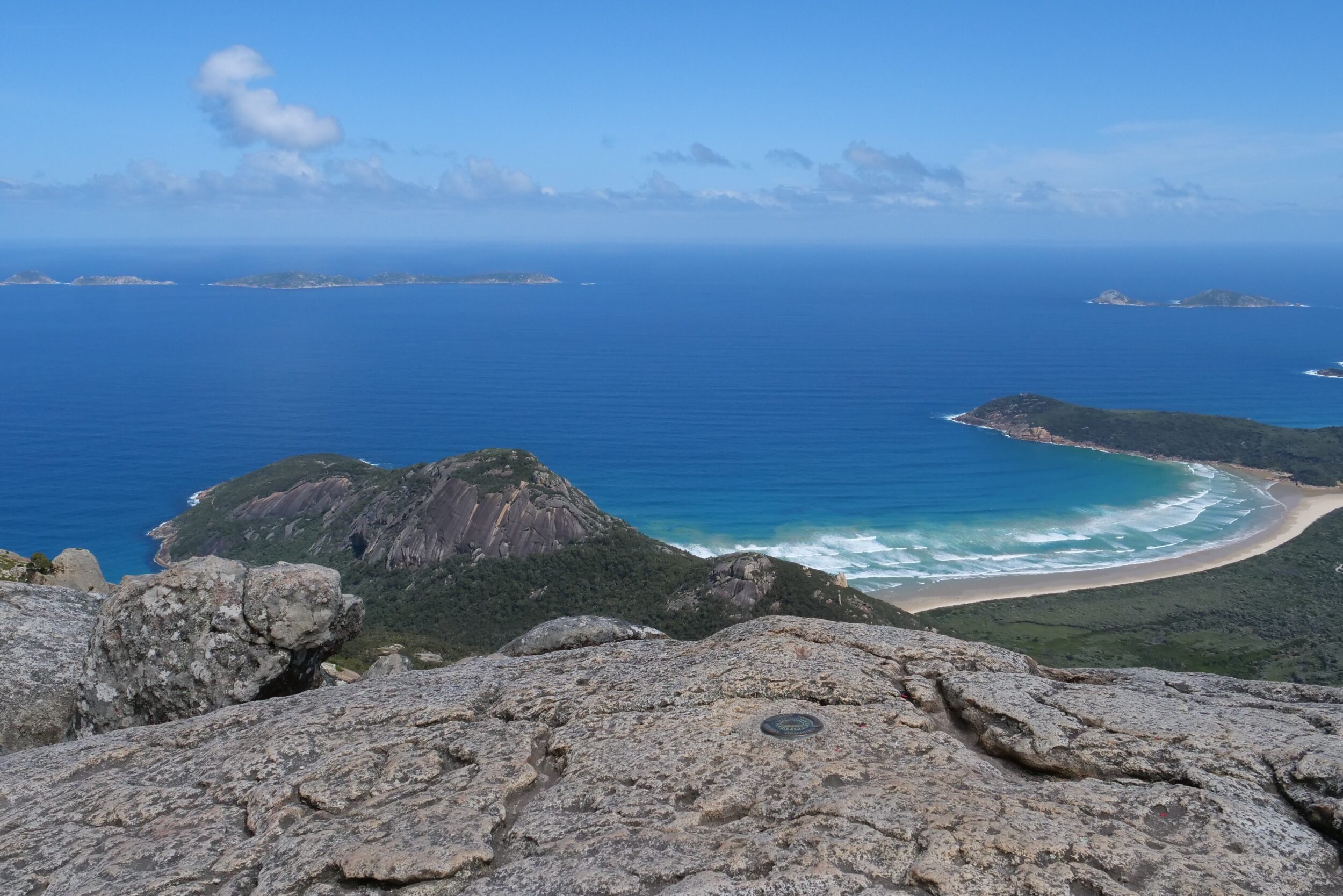
Both of this post’s photos were taken from the summit of Mount Oberon, 558 metres ASL

Leave a Comment

Grand sands (#13 in series: oystercatchers & wet sandy strands)


This and the next several chapters in this series all feature wet sand.

Today’s post also has oystercatchers, in “reflective” mode.

Both of the relevant strands are on the northern edge of the Southern Ocean, according to most Australians.

Comments closed

Intertidal: #4 in series (Shallow Inlet – closer view)

Tidal sand/mud-flats present very different “faces”, depending on when you happen to visit them – time of day, as much as time of year – and also on how closely you look.

Yesterday’s featured photo was taken in the same location as was today’s, their two vantage points were a very short walk apart, and only a few minutes separated their shutter-clicks.

Nothing much had changed in those few minutes, but…

Comments closed

“Gum Trees” & Fire (#37 in “a shining moment” series)


Ever wondered why “gum trees” were so named?

The answer will face your stare, if you examine this post’s image!

It shows a Eucalypt, in the aftermath of the most recent of probably many fires which this tree had survived, very near to the Australian continent’s southernmost point.

Comments closed